Best Property Line App in 2026: 8 Boundary and Survey Apps Compared

How we put this together: we compare official feature and pricing pages, app store listings, privacy policies and public user reviews. Prices change, so check the provider's site before you pay.
Key takeaways
- LandGlide and Regrid are the most focused property line apps, built around parcel records and boundary overlays.
- Hunting and outdoor apps such as onX Hunt and HuntStand also show parcel lines, but they are built for outdoor use first.
- Phone GPS is usually accurate only within several feet, so no app in this list replaces a licensed land survey.
- Parcel data can lag behind recent sales and boundary changes, so verify any line that affects a fence, building, or dispute.
Quick comparison
| Name | Who it suits | Starting price | Free option | |
|---|---|---|---|---|
 LandGlide | Parcel lines and owner lookup | $9.99 per month | Free trial | Visit |
 Regrid | Parcel data on mobile and web | $10 per month | Yes | Visit |
 onX Hunt | Parcel lines plus outdoor navigation | See website | Free trial | Visit |
 HuntStand | Hunting maps with property boundaries | See website | Yes | Visit |
 BaseMap | Outdoor maps with parcel layers | See website | Free trial | Visit |
 Avenza Maps | Offline maps with your own boundary files | Free | Yes | Visit |
 MapPad | Walking and measuring a property line | See website | Free trial | Visit |
 Land ID | Parcel research with map layers | See website | Free trial | Visit |
The best property line and boundary survey apps
This article covers property survey and boundary-mapping apps, since that is what the best property line apps actually do. They show parcel boundaries from county and state records on a map, often with owner names and acreage, and they use phone GPS to show where you stand relative to those lines. None of them is a legal survey, and the guide below explains why that distinction matters before you rely on any line.
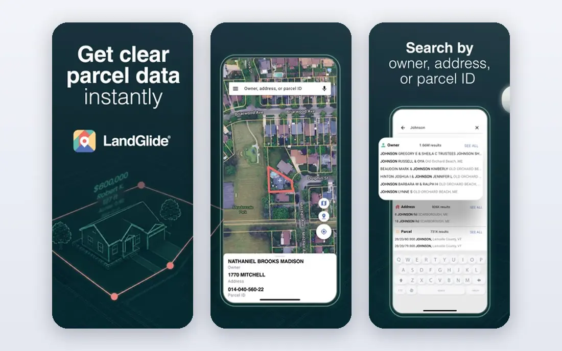
LandGlide is the most single-purpose property line app in this list. It shows parcel boundaries, owner names, acreage, and parcel details on satellite and street maps, and it is built for people checking a property in the field, not for hunting or hiking. Its published terms describe a 7-day free trial, then $9.99 per month or $99.99 per year, which makes it easy to test on a specific property before committing.
The honest limit is data, not design. Parcel lines come from county records, and those records differ in quality and freshness by county, so a line that looks precise on screen may still be off by several feet. LandGlide is excellent for research, neighbor lookup, and a first check before a fence or purchase, but a licensed surveyor should confirm any line that carries legal or construction consequences.
- Parcel-focused design with boundary overlays
- Parcel records covering most of the US population in published terms
- Works on mobile and desktop
- Subscription required after a 7-day trial
- Parcel accuracy varies by county data quality
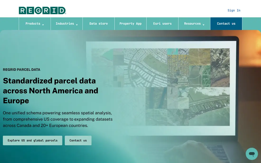
Regrid, formerly known for its parcel data platform, offers a property app with parcel boundaries, owner information, and map layers on both phone and web. Its published terms describe a free Starter tier and a Pro plan at $10 per month or $100 per year for both mobile and web, which suits buyers, agents, and landowners who switch between phone and desk. The web map is a real advantage when researching several parcels at once.
The catch is coverage depth. Urban and suburban counties usually have rich parcel data, while some rural areas have thinner or older records, so check your county before relying on it. Regrid is best for research and comparison, and as with every app here, it should not be treated as a survey for a boundary dispute.
- Parcel data on both mobile app and web
- Pro plan covers both platforms
- Free Starter tier for trying the app
- Full parcel details require Pro
- Some rural counties have thinner data
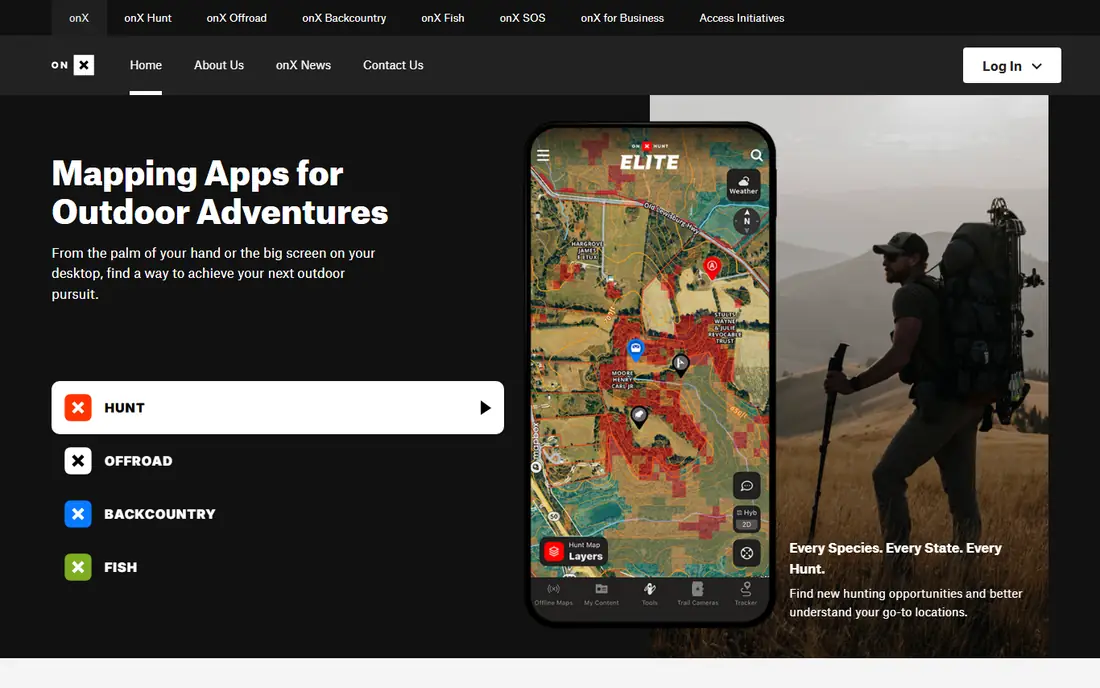
onX Hunt is best known as a hunting app, but its private land layers make it a capable property line tool as well. It shows parcel boundaries, landowner names, and public land designations, alongside topo maps, trails, and offline navigation. That combination suits landowners and buyers who also spend time outdoors and want one map for both jobs.
The trade-off is focus and price structure. Parcel access sits inside membership tiers that vary by single-state, two-state, or nationwide coverage, so the price depends on where you need data. Published listings show a range of annual prices by tier, so check the current onX pricing page for your state before subscribing. As with other apps, verify parcel lines against county records for any high-stakes use.
- Private and public land layers with owner data
- Offline maps and GPS tracking
- Strong outdoor navigation tools
- Built for hunting first, so parcel tools sit inside a larger outdoor app
- Pricing varies by state coverage and tier
HuntStand offers a free base app for maps and scouting, with HuntStand Pro adding property boundary lines, landowner information, 3D maps, and offline mapping in its published terms. That structure lets a user try the maps free, then pay only if parcel layers are needed. It suits hunters, landowners, and rural buyers who want parcel lines alongside weather, trail, and habitat layers.
The limit is the same as with onX Hunt. HuntStand is a hunting platform first, so its parcel tools, while useful, are not as deep as LandGlide or Regrid for research tasks such as comparing many parcels or exporting data. For a landowner who hunts or walks rural land often, though, it is a convenient single app.
- Free base app with maps
- Pro adds property boundaries and landowner info
- 3D maps and offline use
- Property tools are part of a hunting app, not a standalone parcel product
- Pro pricing varies
BaseMap is another hunting app that doubles as a property line app, with land ownership and boundary layers on satellite and topo maps. It suits users who want to scout land, check access, and see who owns neighboring parcels while outdoors, with offline maps for areas without cell service. Its trial lets users test parcel layers in their area before paying.
The downside is research depth. BaseMap is built for outdoor navigation, so it lacks some of the parcel search, filtering, and web research tools that Regrid offers. Choose it when outdoor use is the main job and parcel lines are a useful extra, not when parcel research itself is the main job.
- Hunting and outdoor maps with land ownership layers
- Offline maps
- Works for scouting and land research
- Parcel depth varies by plan and region
- Outdoor focus means fewer parcel research tools
Avenza Maps works differently from the other apps here, and that difference matters. It does not ship with nationwide parcel data, but it lets you load your own maps, including a survey plat, a county map, or a boundary file, and then shows your GPS position on that map offline. For a landowner who already has a survey or a county plat map, that is a powerful and cheap way to walk a boundary in the field.
The catch is the starting file. Without a good map, Avenza shows location but not parcel lines, so it is not a drop-in replacement for LandGlide. It fits best as a companion tool, load a plat map from your surveyor or county, then use Avenza to navigate to corners and lines offline. For that job, its free base app is excellent value.
- Free base app
- Offline maps with GPS location
- Can load your own geospatial boundary files
- Does not include parcel data by itself
- You need a map or file that already shows boundaries
MapPad is a measurement tool rather than a parcel lookup tool. You walk a boundary, field, or lot while the app records the GPS track, then it reports distance and area for the shape you traced. That makes it handy for estimating lot size, fence length, or field acreage when a parcel map is not available or when you want to check a shape on the ground.
The limit is GPS accuracy. Consumer phone GPS is usually accurate within several feet, and can be worse under trees or near buildings, so a MapPad measurement is an estimate, not a survey. Use it for planning and rough checks, and confirm any measurement that affects a sale, fence, or building with a licensed surveyor or a county record.
- Walk a line and record distance and area
- Useful for measuring lots and fields
- Simple GPS track tools
- Measurement depends on phone GPS accuracy
- Not a parcel database, so it does not show owner data
Land ID, formerly known as MapRight, offers parcel research with map layers for buyers, agents, and landowners. It shows parcel boundaries and related map data, which helps when comparing properties, checking access, or researching a rural tract before a visit. Web and mobile access make it useful both at a desk and in the field.
The trade-off is the same data caveat that applies to every parcel app. County records update at different speeds, so a recent sale, split, or boundary adjustment may not yet appear. Land ID is a strong research tool, but it should sit alongside county records and, where stakes are high, a professional survey.
- Parcel data with map layers for research
- Useful for buyers and agents
- Web and mobile access
- Pricing and plan details vary
- Parcel freshness depends on county data
How we picked these
We compared official app listings and pricing pages for apps that show parcel boundaries, support boundary mapping, or measure land on a phone. We favored products that are available today in the US, that state their data source or limits, and that cover different jobs, from parcel lookup to offline plat navigation to field measurement. Where a vendor does not publish a stable price, we used See website, and we excluded apps that only show a street map without boundary or parcel features.
Why no app replaces a licensed survey
Phone GPS, county parcel data, and satellite imagery each carry error, and those errors add up. A parcel line on a map is drawn from records that may be old, generalized for display, or shifted by map projection, while phone GPS can drift several feet. A licensed surveyor, by contrast, measures from recorded monuments and legal descriptions and can certify a boundary for a sale, fence, or building permit.
How to use these apps safely
Use an app to research, to plan a visit, and to spot questions to ask a surveyor or county office. Do not build a fence, place a structure, or challenge a neighbor based only on an app line. If a line matters, order a survey, check the county plat and deed, and keep the surveyor report with your property records.
Frequently asked questions
What is the best app for property lines?
LandGlide is the best focused property line app for most users, while Regrid is best for research across mobile and web. Hunting apps such as onX Hunt are better when outdoor navigation is also needed.
What is the best free property line app?
Regrid offers a free Starter tier, HuntStand offers a free base app, and Avenza Maps is free for loading your own maps. Free tiers limit parcel detail, so expect to pay for full owner and boundary data.
What is the best app for finding property lines?
An app that uses county parcel data, such as LandGlide or Regrid, is best for finding lines, since it shows recorded boundaries rather than only a GPS track. Check your county coverage before subscribing, since data quality varies.
How accurate are property line apps?
Parcel lines on an app are estimates drawn from county records and displayed on a phone map, with phone GPS usually accurate only within several feet. They are useful for research, but they are not accurate enough for a legal boundary, fence placement, or building setback.
Do I need a survey if I have a property line app?
Yes, for any sale, dispute, fence, or building near a boundary, a licensed survey is still needed. An app can guide research and questions, but only a surveyor can certify where a legal boundary lies.
Sources we checked (8)

Online Jobs is an independent blog about careers, online work, learning new skills and the tools that help people earn. More about us.
Keep reading
All posts
n8n Alternatives
n8n alternatives compared for 2026, with Zapier, Make, Activepieces, and more, covering visual builders, code steps, self-hosting, and pricing models.

ZoomInfo Alternatives
The best ZoomInfo alternatives in 2026, compared on price, free plans, data coverage, and which tool fits small teams or large sales teams best in detail.
Workday Alternatives
We compared the best workday alternatives for HR, payroll, and global hiring, from BambooHR and Gusto to Rippling, Deel, and HiBob for growing teams in 2026.