Best GPS App in 2026: 9 Apps Compared

How we put this together: we compare official feature and pricing pages, app store listings, privacy policies and public user reviews. Prices change, so check the provider's site before you pay.
Key takeaways
- Google Maps is the best GPS app for most people because it combines driving, walking, cycling, and transit directions with strong business and place data.
- Waze wins for commuters who want live driver reports on traffic, hazards, and police, but it needs a data connection for its best features.
- HERE WeGo and OsmAnd are the picks for offline travel, since whole regions can be downloaded before a trip into weak signal areas.
- Family tracking is a separate job from navigation, and Life360 covers it better than any driving app on this list.
Quick comparison
| Name | Who it suits | Starting price | Free option | |
|---|---|---|---|---|
 Google Maps | All-round navigation | Free | Yes | Visit |
 Waze | Live traffic and driver alerts | Free | Yes | Visit |
 Apple Maps | iPhone owners | Free | Yes | Visit |
 HERE WeGo | Offline maps | Free | Yes | Visit |
 Sygic | Premium offline driving | Free | Yes | Visit |
 TomTom GO | Long-distance drivers | See website | Free trial | Visit |
 MapQuest | Simple US driving directions | Free | Yes | Visit |
 OsmAnd | Privacy-minded offline maps | Free | Yes | Visit |
 Life360 | Family tracking | Free | Yes | Visit |
The best GPS apps
A GPS app has to do one thing perfectly, which is get you to the right place without drama, and the best ones add live traffic, offline maps, or family location on top. We compared official feature pages, app store listings, and public documentation for each app below, and we focused on what each one does best rather than crowning a single winner for every driver.
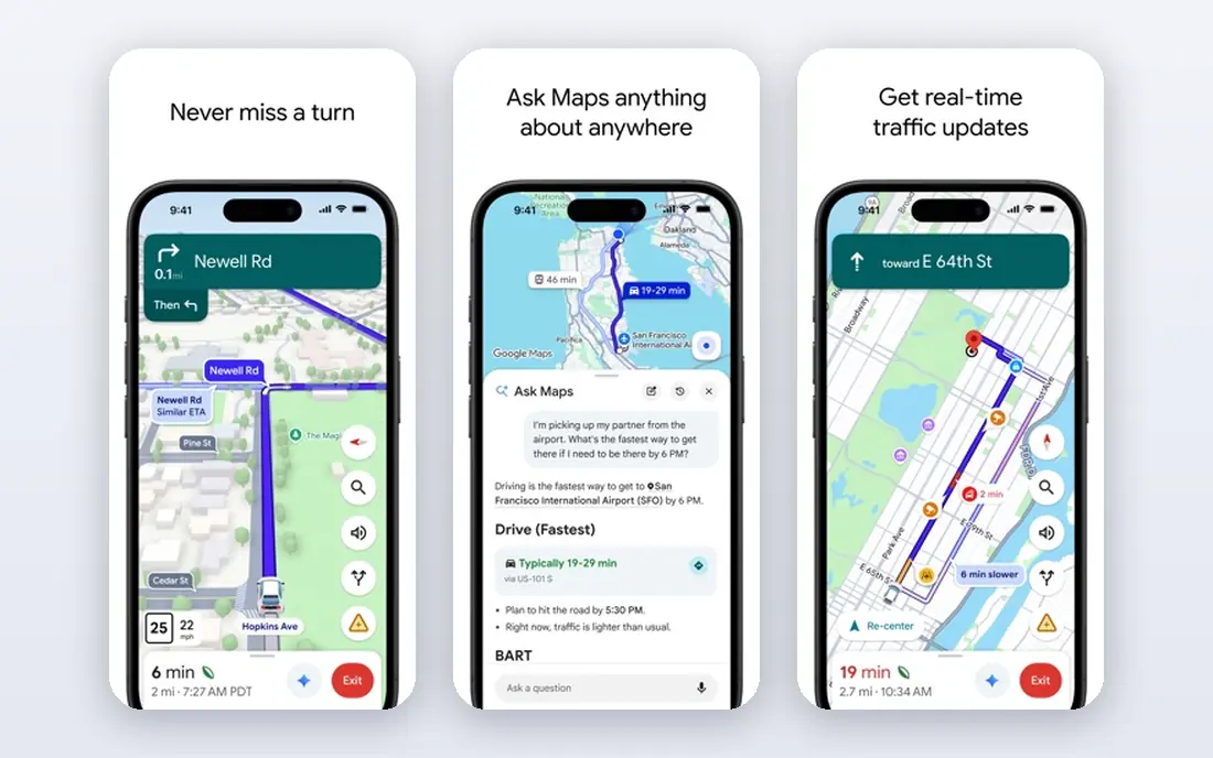
Google Maps is our pick for most people, and the reason is coverage. Its search finds businesses, hours, reviews, and photos that smaller maps miss, and its directions cover driving, walking, cycling, and public transit in one place. Multi-stop routing, live traffic with alternate routes, and downloadable offline areas make it useful for a daily commute and a road trip alike, and it works on Android, iPhone, and the web.
The honest drawback is privacy. Google's location data practices are tied to a broad services and advertising ecosystem, so users who want minimal data collection should look at HERE WeGo or OsmAnd instead. Google Maps can also route conservatively, sticking to main roads where a local driver might know a faster cut-through. For most drivers, though, the completeness of the data outweighs those complaints.
- Best place data and search
- Driving, walking, cycling, and transit in one app
- Downloadable offline areas
- Location data feeds a large advertising ecosystem
- Traffic routing can favor major roads over local shortcuts
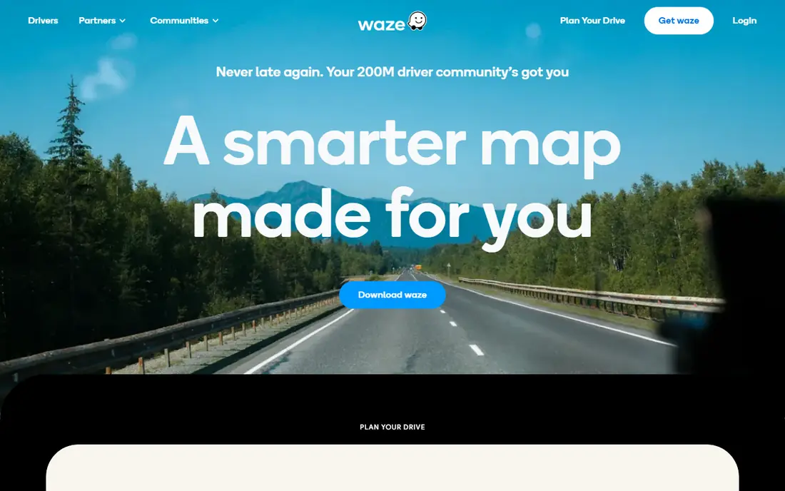
Waze is the app commuters open when they already know the route and want to know what is wrong with it today. Other drivers report crashes, hazards, road closures, and police, and Waze reroutes around trouble quickly, often before a traffic algorithm alone would notice. The community feel is the whole point, and in busy cities it regularly saves more time than any other free app.
The limits matter too. Waze is a driving app first, so walking, cycling, and transit directions are thin, and full offline maps are not its strength. It also shows ads, and its shortcut suggestions sometimes send drivers down narrow residential streets. Keep Google Maps or Apple Maps installed alongside it for everything that is not a car journey.
- Real-time driver reports on hazards, traffic, and police
- Strong rerouting around jams
- Works with Android Auto and CarPlay
- Needs a data connection for live features
- Contains ads
- Weaker for walking, transit, and offline use
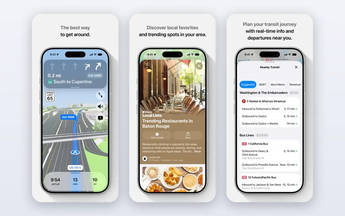
Apple Maps is the obvious pick if you live inside the Apple ecosystem. It integrates with Siri, CarPlay, Apple Watch, and your calendar, so directions can start from a meeting invite without extra taps. The design is clean, turn guidance is clear, and Apple collects less personal data tied to advertising than Google does, which matters to privacy-minded drivers.
The catch is the platform lock-in. Apple Maps is only available on Apple devices, so Android households cannot share it, and its business listings and reviews are thinner than Google's in some towns and rural areas. If you drive an iPhone and value privacy and integration over the deepest place database, Apple Maps is an excellent daily driver.
- Deep iPhone, CarPlay, and Apple Watch integration
- Clean design
- Strong privacy stance
- Apple devices only
- Place data is thinner than Google Maps in some areas
HERE WeGo is the app to install before a trip abroad or into rural areas with patchy signal. Entire countries or regions download for offline navigation, so the app keeps guiding when your data connection drops. It covers driving, walking, and public transit, and it has long been a favorite for travelers who do not want to buy a local SIM just for maps.
Live features are the compromise. Traffic alerts and community reports are thinner than Waze or Google Maps, so HERE WeGo is a better backup navigator than a commuter's first choice in a busy city. Pair it with a live traffic app at home, and let it carry the trip when you travel beyond reliable coverage.
- Whole countries downloadable for offline use
- Works well abroad
- Driving, walking, and transit directions
- Live traffic alerts are weaker than Waze
- Smaller community of reporters
Sygic is a long-running navigation app built around offline maps and driver assistance features. Download maps by region, get turn-by-turn guidance without a connection, and add features such as speed camera warnings where local law allows them. The head-up display mode, which projects directions onto the windshield view through the phone, is a neat touch for night driving.
The free version covers basic navigation, but the features that make Sygic stand out sit behind paid plans, so check the current pricing on its site before assuming a feature is included. The interface is also busier than Google Maps, with more menus to learn. Drivers who want a polished offline navigator and are willing to pay for it will get their money's worth.
- High-quality offline maps
- Head-up display option
- Speed camera warnings where legal
- Best features sit behind paid plans
- Interface is busier than Google Maps
TomTom GO brings the company's decades of mapping and traffic data to the phone, and long-distance drivers are its natural audience. Offline maps, clear lane guidance, and speed camera alerts make motorway and cross-country driving calmer, and TomTom's traffic data is among the best in the business. If you drive long distances regularly, the quality of the routing shows.
The model is a subscription after a free trial period, so TomTom GO is not a free forever app like Google Maps or Waze. It is also a driving tool first, with little to offer walkers or transit riders. Drivers who want premium traffic data and offline reliability, and who drive enough to justify a subscription, are the right audience.
- Trusted TomTom traffic data
- Offline maps
- Lane guidance and speed camera alerts
- Subscription required after the trial
- Less useful for walking and transit
MapQuest is the veteran of online directions, and it still does the core job well. Enter a start and a destination, get clear driving directions, and plan multi-stop routes on the web without signing up for anything. For a driver who wants simple directions without the weight of a full mapping platform, MapQuest is refreshingly direct.
The app side feels less modern than its rivals, and live traffic, community reports, and transit options are thinner. MapQuest is best as a quick web tool for route planning rather than a daily navigation app. Keep it in mind for planning a route on a computer, then send the directions to your phone app of choice.
- Simple and familiar directions
- Multi-stop route planning on the web
- No account needed for basic use
- Fewer live features than Google Maps or Waze
- App feels less modern
OsmAnd is built on OpenStreetMap data and aimed at users who want maps without handing location data to a large advertising company. Offline maps are a core strength, with detailed topographic and cycling layers that hikers and cyclists appreciate, and the app works on Android and iPhone. The open data model also means maps improve wherever volunteers contribute.
The learning curve is real. The interface packs in many options, and a new user can feel lost before the first route starts. Live traffic is limited compared with Waze or Google Maps. For privacy-minded travelers, hikers, and cyclists who are willing to spend an evening learning the app, OsmAnd is a strong and principled choice.
- Built on OpenStreetMap data
- Strong offline maps
- No advertising tracking in the core app
- Interface takes learning
- Live traffic is limited
Life360 answers a different question from the rest of this list, which is where are the people I care about. Family members share real-time location, set place alerts for home or school, and get driving safety reports and crash detection alerts on paid plans. For parents tracking teen drivers or families coordinating pickups, that combination is genuinely useful.
Be clear about what it is not. Life360 does not navigate, and its location sharing can feel intrusive if every family member has not agreed to it. Talk through the privacy side before installing it, and treat it as a companion to a navigation app rather than a replacement. For the best tracking app for family use, it is the most complete option we found.
- Real-time family location sharing
- Driving safety reports
- Crash detection and alerts
- Not a navigation app
- Location sharing raises privacy questions within families
How we picked these
We compared official feature pages and app store listings for each app, and we tested the logic of the list against real driving needs: daily commuting, long trips, offline travel, and family tracking. We favored apps that are actively maintained and available in the US, and we noted where paid plans gate the best features so readers are not surprised. We did not claim hands-on testing we did not do, and prices reflect what vendors publish on their own sites.
How to choose the right GPS app
Start with your most common trip. A city commuter needs live traffic and fast rerouting, so Waze or Google Maps fits. A traveler heading into mountains or abroad needs offline maps first, so HERE WeGo, Sygic, or OsmAnd should be installed before departure. A family needs location sharing, which is Life360 territory rather than a navigation feature.
Using two apps together
Most experienced drivers run two apps, and there is no rule against it. Use Waze for live traffic on the commute and Google Maps for everything else, or pair an offline app with a live one on a road trip. The phone handles both, and the combination covers gaps that no single app fills alone.
Offline maps checklist
Download your maps on Wi-Fi before you leave, and download a wider area than you think you need. Test the offline route once while still at home, and carry a car charger, since navigation with the screen on drains a battery faster than almost any other phone task.
Frequently asked questions
What is the best GPS app overall?
Google Maps is the best GPS app for most people because it covers driving, walking, cycling, and transit with the deepest place data. Waze is better for pure commuting thanks to live driver reports, and Apple Maps is best for iPhone owners who value integration and privacy.
What is the best tracking app for family?
Life360 is the best tracking app for family use on this list, with real-time location sharing, place alerts, driving safety reports, and crash detection on paid plans. Agree on privacy boundaries as a family before turning sharing on, and remember it is a tracking app, not a navigation app.
Which GPS app works best without internet?
HERE WeGo and OsmAnd are the strongest offline picks, since whole regions download in advance. Sygic and TomTom GO also offer solid offline maps, with their best features behind paid plans. Download maps on Wi-Fi before any trip into weak signal areas.
Is Waze or Google Maps better for traffic?
Waze is better for live driver reports on crashes, hazards, and police, while Google Maps is better for overall routing, place search, and multi-modal trips. Many drivers use Waze on the commute and Google Maps for everything else.
Are these GPS apps free?
Google Maps, Waze, Apple Maps, HERE WeGo, MapQuest, and the core versions of Sygic and OsmAnd are free. TomTom GO uses a subscription after a trial, and Life360 offers a free plan with paid plans adding driving safety and crash features.
Sources we checked (9)

Online Jobs is an independent blog about careers, online work, learning new skills and the tools that help people earn. More about us.
Keep reading
All posts
Zoom Alternatives
Zoom alternatives compared for 2026: Google Meet, Microsoft Teams, Webex, Jitsi and more for free calls, large meetings and webinars for teams and classrooms.

What Is the Best Free Tool to Rotate a PDF
What is the best free tool to rotate a PDF? We compare eight free rotation tools on per-page control, limits, privacy and saved output quality in detail.

What Is the Best AI Dubbing Tool
We compared the best AI dubbing tools in 2026, from ElevenLabs and HeyGen to Rask AI, Dubverse and Veed, for videos and creators in many languages worldwide.